- Date
- 2026/07/06(Mon) 13:15-18:00
- Venue
- Online/301 : Seminar Room, ILCAA
- ILCAA Joint Research Project
- General
Spatial Structure Analysis of Historic Cairo and the Integrated Development of a Map- and Streetscape-Data Archive
ID: jrp000319
KeywordCairo; urban morphological analysis; networks; maps; archives
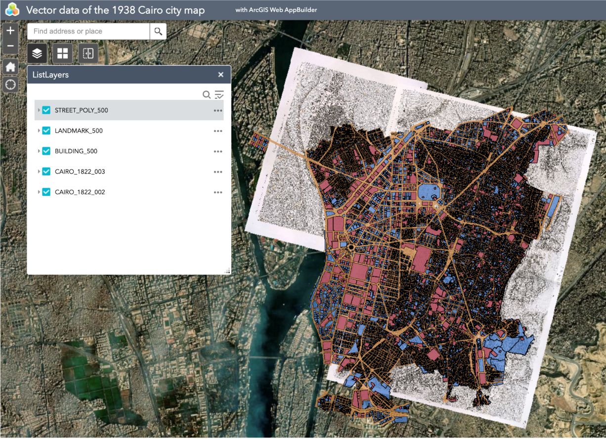
This project analyzes Historic Cairo’s spatial structure using GIS and Space Syntax, integrating historical maps with landscape records. By vectorizing early 20th-century maps (1:500 and 1:1000), we enable diachronic comparisons of urban form. Our workflow digitizes earlier, non-georeferenced maps while preserving historical context and correcting geometric distortions. Cross-referencing cartographic data with textual and visual sources, we identify gaps between representation and lived perception. Finally, these heterogeneous datasets will be integrated into sustainable, IIIF-compliant online resources, ensuring interoperability with partner archives through continuous streetscape documentation.
- Date
- 2026.04.01~2029.03.31
- Member
-
Coordinator : KUMAKURA Wakako
Co-Coordinator : FUKAMI Naoko, GOTO Emi
Joint Researchers : ELSHAYEB Yasser, IWATA Kazuma, KAMEYA Manabu, KAWAMOTO Satoshi, NAKAMURA Satoru, SATO Susumu, YOSHIMURA Takenori