The Holy Land in Tranquility: Palestine and Lebanon as Seen in Lithographic Landscapes from the Mid-Nineteenth Century
Scenery of the Regions Surveyed and Depicted by a Multitalented Former Officer from the Netherlands
Date: May 12 (Monday) – June 20 (Friday), 2014
10:30 am until 05:00 pm (Closed on Saturdays, Sundays, and public holidays) Admission free
Place: ILCAA, Floor 1, Exhibition Room
Sponsor: ILCAA
 |
C.W.M. Van de Velde |
The Multitalented Van De Velde
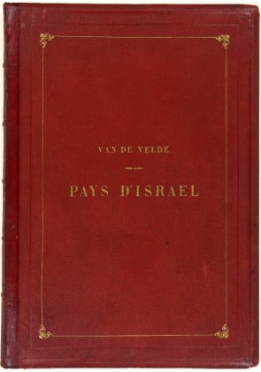
Charles W. M. Van de Velde (1818–98) the author of the lithographic collection held by ILCAA and displayed here today entitled Le Pays d’Israël: collection de cent vues prises d’après nature dans la Syrie et la Palestine, Paris, 1857, was a man of many talents. Seeking to follow in his father’s footsteps, he joined the Dutch navy as an officer at the tender age of 14. In 1839, having only just reached adulthood, he left to spend two years at his post in Jakarta, Indonesia, which was a Dutch territory at the time. While in Jakarta, he mastered surveying and cartography. He also honed his sketching skills, which made the best use of his natural artistic talents, surveyed the island of Java, and drew landscapes of various places throughout the island. Upon his return to the Netherlands in 1844, he published fifty lithographs of these landscapes and a map of Java. (Gezigten uit Neerlands Indie, naar de natuur geteekend en beschreven, 1844; Kaart van het Eiland Java, 1845).
The Holy Land Becomes the Land of Conflict
As an ardent protestant, Van de Velde fervently desired that the field survey and information recording techniques he had mastered as a naval officer be put to use in the holy land of Jerusalem and its surrounding areas. After leaving the navy in 1846, he spent two years – 1851 to 1852 – surveying the land of what is today Lebanon and Palestine. Around ten years earlier, there had been frequent clashes between the Maronite Christians and the Druze community in Lebanon. Van de Velde’s survey took place during a brief period of tranquility, but the situation deteriorated into a large scale civil conflict in 1860. A violent incident also took place in 1846 in Palestine between the Christian sects over the right to manage the Church of the Holy Sepulchre. This incident became the catalyst for the Crimean War, which began in 1853 and pitted Russia against Britain, France, and the Ottoman Empire. This event took place before the dramatic change brought by the settlement of Jews in Palestine, which began in almost seventy years later, and the establishment of the state of Israel in 1948.
Series of Palestine and Lebanon Travelogues
The results of Van de Velde’s field surveys have also been preserved in a number of other memoirs aside from Le Pays d’Israël. Van de Velte created a succession of works comprising a travelogue in which he recorded his thoughts and feelings in the first person (Reis door Syrië en Palestina in 1851 en 1852., 1854, published in English in the same year and published in Germany the following year), the earlier mentioned lithographic collection of 100 landscapes for this travelogue, a detailed map of Palestine and Jerusalem based on his survey (Map of the Holy Land. 1858), and a memoir to accompany this map (Memoir to Accompany the Map of the Holy Land, 1858). At the time, there were many travelogues written by Europeans detailing their travels in Palestine and other parts of the world, but most of these works ultimately focused on the main text, and maps and pictures were inserted as mere appendixes. Van de Velde’s ability to present all of these works, each of which represented a different genre, as one independent body of work is astonishing. In later years, his efforts would contribute considerably to the establishment of biblical geography as an academic discipline.
The devout Van de Velde would later play an important role as one of the key figures involved in the foundation of the International Red Cross.

1851, The Change from Landscape Painting to Landscape Photography, Past and Present
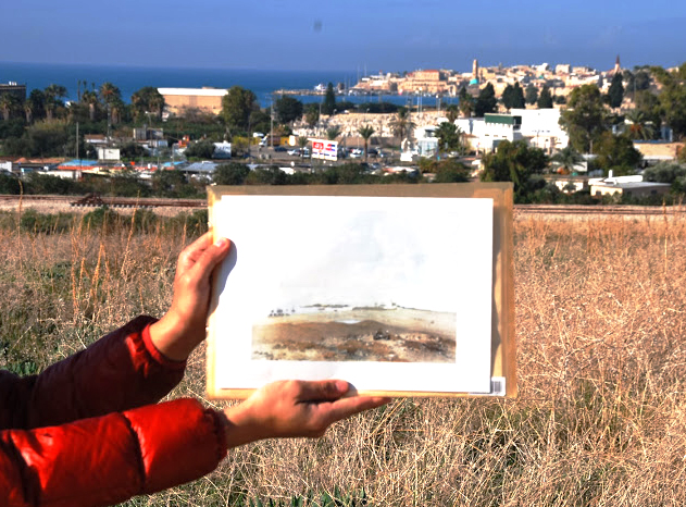
The daguerreotype, the world’s first practical photographic process, was introduced in 1839. Van de Velde visited the Holy Land in 1851. This was the year in which the Collodion process was established, and it marked a period of change from landscape painting to landscape photography. The works left by Van de Velde are faithful records and reproductions of the landscape, and we may consider them as the work in the last phase of the age of lithographs. In this exhibition, visitors can also view digital photographs taken by ILCAA researchers in the land that Van de Velde depicted and thereby get a sense of the tranquil scenery of the land of some 160 years ago, which contrasts with that of today.